[{"id":198659375259,"handle":"australian-made","updated_at":"2025-04-16T07:45:05+10:00","published_at":"2020-05-31T22:29:12+10:00","sort_order":"manual","template_suffix":"","published_scope":"global","title":"Australian Made","body_html":"\u003cp\u003e\u003cspan\u003eExplore the essence of Australia with our curated collection of Australian-made products at Adventure Awaits. Immerse yourself in the unique craftsmanship, quality, and innovation that define the spirit of the Land Down Under. From sustainable goods to handcrafted treasures, each item in our collection tells a story of authenticity and adventure. Elevate your journey with products that capture the heart and soul of Australia, proudly crafted and sourced locally. Discover the best of Australian-made excellence – because every adventure should be as unique as the land it comes from.\u003c\/span\u003e\u003c\/p\u003e\n\u003cp\u003eIncluding our own Aussie made products - Travel Journal, Caravan\/Camper Log Book, Map of Australia Stickers \u0026amp; our award winning Slide n' Dry Pegless Clotheslines.\u003c\/p\u003e\n\u003cp\u003eYou can also check out all our products \u0026amp; gift ideas in our \u003ca href=\"https:\/\/www.adventureawaits.com.au\/collections\/australiana-themed\" target=\"_blank\"\u003eAustraliana Themed collection!\u003c\/a\u003e\u003c\/p\u003e","image":{"created_at":"2020-05-31T22:31:51+10:00","alt":null,"width":2000,"height":2000,"src":"\/\/www.adventureawaits.com.au\/cdn\/shop\/collections\/australian_made_products.jpg?v=1737788463"}},{"id":201735798939,"handle":"caravanning-camping","updated_at":"2025-04-16T07:45:05+10:00","published_at":"2020-06-19T11:34:47+10:00","sort_order":"manual","template_suffix":"","published_scope":"global","title":"Caravanning \u0026 Camping","body_html":"\u003ch2\u003eEmbark on a journey of discovery with our handpicked selection of unique caravanning and camping accessories at Adventure Awaits.\u003c\/h2\u003e\n\u003cp\u003eElevate your outdoor experiences with innovative and practical gear designed to enhance every aspect of your adventure. From compact and lightweight solutions to stylish and functional accessories, our collection is a testament to the spirit of exploration. Adventure Awaits is your online destination for exclusive camping essentials that combine convenience, quality, and a touch of wanderlust. Make your next camping trip extraordinary with accessories as unique as your journey.\u003c\/p\u003e\n\u003cp\u003eMake your adventure complete with our Australian made caravan essentials - including Slide n' Dry Pegless Clotheslines, Caravan Log Books \u0026amp; more.\u003c\/p\u003e"},{"id":416559694045,"handle":"everything-excluding-onsale","title":"EVERYTHING excluding ONSALE","updated_at":"2025-04-16T09:25:02+10:00","body_html":"","published_at":"2023-03-19T20:35:31+11:00","sort_order":"created-desc","template_suffix":"","disjunctive":false,"rules":[{"column":"tag","relation":"equals","condition":"ALL"}],"published_scope":"web"},{"id":269851459776,"handle":"fathers-day","updated_at":"2025-04-16T07:45:05+10:00","published_at":"2021-05-25T21:23:17+10:00","sort_order":"manual","template_suffix":"","published_scope":"global","title":"Father's Day","body_html":"\u003cdiv\u003e\n\u003cdiv dir=\"auto\"\u003e\n\u003cdiv\u003e\n\u003cdiv\u003e\n\u003cp\u003e\u003cspan style=\"font-size: 0.875rem;\"\u003eWe've got your Dad, Grandad, Pa, Pop, Special Fella's Father's Day Gift sorted with our huge range of fantastic, fun and practical products - guaranteed to put a smile on their face this Father's Day! We've picked over 500 of the BEST!!\u003c\/span\u003e\u003cbr\u003e\u003c\/p\u003e\n\u003c\/div\u003e\n\u003c\/div\u003e\n\u003c\/div\u003e\n\u003c\/div\u003e\n\u003cp\u003eFrom \u003ca href=\"https:\/\/www.adventureawaits.com.au\/collections\/alcoholder\/products\/alcoholder-stubzero-can-stubby-cooler-available-in-six-colours\" rel=\"noopener noreferrer\" target=\"_blank\"\u003eStubby Coolers\u003c\/a\u003e to \u003ca href=\"https:\/\/www.adventureawaits.com.au\/collections\/ticket-to-the-moon-hammocks-and-straps\" rel=\"noopener noreferrer\" target=\"_blank\"\u003eHammocks\u003c\/a\u003e, From \u003ca href=\"https:\/\/www.adventureawaits.com.au\/search?q=beard\" rel=\"noopener noreferrer\" target=\"_blank\"\u003eBeard Shampoo\u003c\/a\u003e to \u003ca href=\"https:\/\/www.adventureawaits.com.au\/products\/tooletries-the-back-scrubber?_pos=1\u0026amp;_sid=7f27d3916\u0026amp;_ss=r\" rel=\"noopener noreferrer\" target=\"_blank\"\u003eBack Scrubber\u003c\/a\u003es, From\u003ca href=\"https:\/\/www.adventureawaits.com.au\/collections\/klipsta-hat-clips\" rel=\"noopener noreferrer\" target=\"_blank\"\u003e Specs Holder\u003c\/a\u003e to \u003ca href=\"https:\/\/www.adventureawaits.com.au\/search?q=coffee+\" rel=\"noopener noreferrer\" target=\"_blank\"\u003eCoffee Cups\u003c\/a\u003e, From \u003ca href=\"https:\/\/www.adventureawaits.com.au\/collections\/caravanning-camping\" rel=\"noopener noreferrer\" target=\"_blank\"\u003eCamping Gear\u003c\/a\u003e to \u003ca href=\"https:\/\/www.adventureawaits.com.au\/search?q=dad\" rel=\"noopener noreferrer\" target=\"_blank\"\u003eDad Books...\u003c\/a\u003e\u003c\/p\u003e\n\u003cp\u003e\u003cstrong\u003eTOP SELLERS FOR 2022:\u003c\/strong\u003e\u003c\/p\u003e\n\u003cp\u003e\u003ca href=\"https:\/\/www.adventureawaits.com.au\/collections\/the-standard-squeeze-bottle\" target=\"_blank\"\u003eThe Standard Squeeze\u003c\/a\u003e \u003c\/p\u003e\n\u003cp\u003e\u003ca href=\"https:\/\/www.adventureawaits.com.au\/collections\/tooletries-bathroom-organisers\" data-mce-fragment=\"1\" target=\"_blank\" data-mce-href=\"https:\/\/www.adventureawaits.com.au\/collections\/tooletries-bathroom-organisers\"\u003eTooletries Bathroom Organisers\u003c\/a\u003e\u003c\/p\u003e\n\u003cp\u003e\u003ca href=\"https:\/\/www.adventureawaits.com.au\/collections\/bug-a-salt\" rel=\"noopener noreferrer\" target=\"_blank\"\u003eBug-A-Salt\u003c\/a\u003e\u003c\/p\u003e\n\u003cp\u003eTOP SELLERS for 2021 - \u003ca href=\"https:\/\/www.adventureawaits.com.au\/collections\/tooletries-bathroom-organisers\" target=\"_blank\"\u003eTooletries Bathroom Organisers\u003c\/a\u003e\u003c\/p\u003e\n\u003cp\u003eTOP SELLERS for 2021 - \u003ca href=\"https:\/\/www.adventureawaits.com.au\/collections\/alcoholder\" target=\"_blank\"\u003eAlcoholder Range incl. STUBZERO!\u003c\/a\u003e\u003c\/p\u003e","image":{"created_at":"2024-08-27T20:03:17+10:00","alt":null,"width":900,"height":900,"src":"\/\/www.adventureawaits.com.au\/cdn\/shop\/collections\/tooletries_harvey.png?v=1724752998"}},{"id":199904559259,"handle":"gifts-for-him","updated_at":"2025-04-16T07:45:05+10:00","published_at":"2020-06-08T20:43:15+10:00","sort_order":"manual","template_suffix":"","published_scope":"global","title":"Gifts for Him","body_html":"Unique gifts for the boys \u0026amp; men in your life. Unique \u0026amp; practical and some for fun."},{"id":198661734555,"handle":"hema-maps","updated_at":"2025-04-15T13:55:01+10:00","published_at":"2020-05-31T22:49:00+10:00","sort_order":"created-desc","template_suffix":"","published_scope":"global","title":"Hema Maps","body_html":"\u003cp\u003eDo you love pouring over a 'real' map, planning your next adventure? Hema Maps are Australia's most trusting maps. Comprehensive, full of detail and the perfect accompaniment for your next road trip. We have a wonderful selection from all your favourite regions \u0026amp; states - including Hema Map wallets and Large laminated maps of Australia. Buy Hema Maps online at Adventure Awaits.\u003c\/p\u003e","image":{"created_at":"2020-05-31T22:55:23+10:00","alt":null,"width":800,"height":800,"src":"\/\/www.adventureawaits.com.au\/cdn\/shop\/collections\/hema_maps.jpg?v=1590929724"}},{"id":199904788635,"handle":"maps","updated_at":"2025-04-16T07:05:05+10:00","published_at":"2020-06-08T20:43:15+10:00","sort_order":"manual","template_suffix":"","published_scope":"global","title":"Maps","body_html":"We have a wonderful selection of maps for your travelling adventures. Nothing beats pouring over a 'real' map and planning your trip. We stock HEMA MAPS, the best in Australia and our popular Aussie made Map of Australia Stickers."},{"id":198542622875,"handle":"travel","updated_at":"2025-04-16T09:25:01+10:00","published_at":"2020-05-30T23:00:38+10:00","sort_order":"best-selling","template_suffix":"","published_scope":"global","title":"Travel","body_html":"Travel accessories for the whole family","image":{"created_at":"2020-05-30T23:10:49+10:00","alt":null,"width":5184,"height":3456,"src":"\/\/www.adventureawaits.com.au\/cdn\/shop\/collections\/perth_win_6.jpg?v=1590844250"}},{"id":201735176347,"handle":"travel-accessories","updated_at":"2025-04-16T09:25:01+10:00","published_at":"2020-06-19T11:34:47+10:00","sort_order":"manual","template_suffix":"","published_scope":"global","title":"Travel Accessories","body_html":"An eclectic mix of wonderful products that are great for when you are travelling. All of them have been tried, tested and LOVED by our team and make fabulous Travel Gifts that can also be used at home."}]
Shipping Australia Wide every day from Regional Victoria...
Description
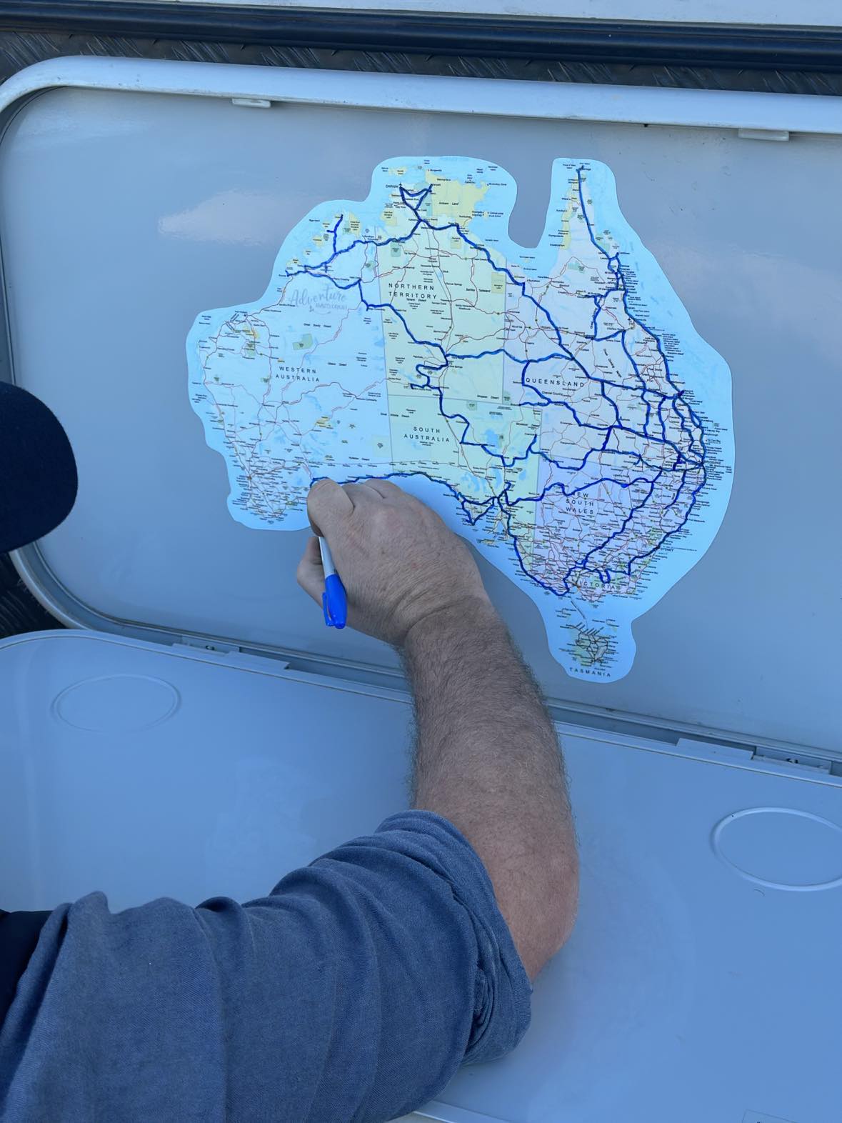
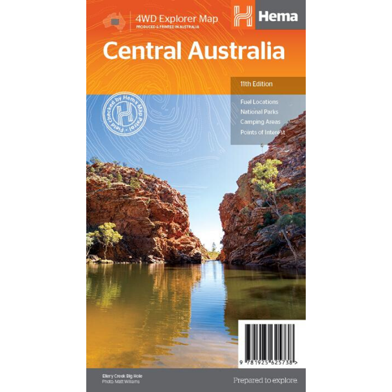
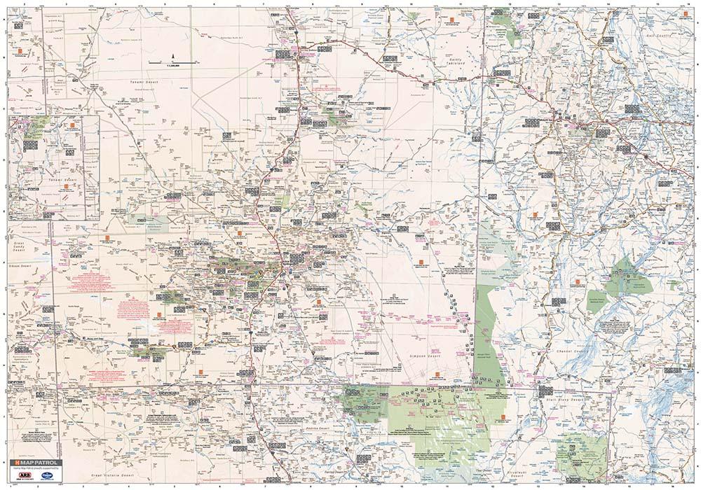
Discover Australia's ancient heartland with this waterproof map of Central Australia. Plan your next trip with this detailed map of the area around Alice Springs. A trip to tick of the bucket list!
Central Australia Map (11th edition) This waterproof map of the Central Australia region is ideal for discovering some of Australia's most iconic landscapes. The main map covers the area around Alice Springs, including Uluru, Kata Tjuta, West MacDonnell Range, as well as the Simpson Desert and popular tracks such as the Hay River Track.
The map also features additional information related to permits, useful contacts and historical context surrounding some of the area's most popular tourist destinations.
Famtastic! Easy to open and no plastic touching food.
This is a great insulated jar, easy for my 7 year old to open on his own. He told me the food is hot at lunch time. I love that there is no plastic touching the food, many brands have plastic under the lid and this one is one of the only brands tha has metal under the lid.
A must have for all those traversing this wonderful country! All relevant information can be logged in one easy location for future reference. Handy size and lightweight is also a bonus. I was going to do a similar journal in a diary, but this is just perfect. Happy travels :-)
Disappointed that the Mozzie Cream has a very short expiration date (Sep 2025) & I think due to this the contents are hard and takes an effort to get it out of container. I purchased the same cream directly from Good Riddance website FEB 24 & the expiration date is 2027. Happy with everything else I purchased.
Thank you Karin for your feedback - we will certainly be checking all the dates now from our latest delivery and we are sorry this has a short date - we have processed an extra discount for you for the inconvience. THanks again for letting us know - we are glad the rest is in good nic and you are happy. Have a lovely day and safe travels...